|
|

|
|

|
Geologist
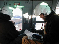
Tim Paulsen identifies volcanic cones from the air Peter
Braddock photographs them. Click to enlarge.
|

|
|
|
|

|
|
Flying
Geologists
|

|
Ground
truth from the air.
by Paul Doherty
December
22 , 2001
Stresses
are pulling apart McMurdo station, geologic stresses, and
yet there are almost no earthquakes around here. Why is that?
McMurdo is located in the Mt. Terror rift zone, a place where
the continental crust is being pulled apart resulting in deep
valleys. Unlike other rift zones on earth, this one is covered
by glaciers, what role do they play in suppressing earthquakes?
With questions like these it is not surprising that a large
fraction of the Antarctic population is made up of geologists.
One geology team has the office next to ours in Crary Lab.
It is lead by professor Terry Wilson from Ohio State University.
They are hunting for the stresses in the crust of Antarctica
by looking for straight lines of volcanic cones. Lines of
cones indicate where the crust has been weakened by the spreading
of the rift zone. Molten magma makes its way to the surface
through these weaknesses.
I
watched the team work day and night, marking air photos and
space photos with locations of possible craters, then boarding
helicopters to fly out and look closely at the cones to make
sure that they really were cones and not just a trick of the
light. They were geologists in search of "ground truth."
Their flights revealed that some "cones" were indeed
illusions
.
One day they invited me to join them on their search. I accepted
then grabbed my ECW (extreme cold weather) gear and met them
at the heliport.
We
donned our flight helmets, loaded the "Huey" helicopter
with our equipment: cameras, air photos, notebooks and sledge
hammers. When I saw the sledge hammers I knew this was going
to be an interesting trip. Our pilot Chris flew across the
ice of McMurdo sound, past Mt. Discovery to Mt. Morning a
volcano covered with smaller cones. From the moment we spotted
our first cone the geologist team sprang into high gear. Terry
called out instructions to the pilot, Peter Braddock and Tim
Paulsen took videos and digital still images of every cone,
Jon Koenig photographed cones with a film camera.
After
a half-hour Terry asked Chris to land in the flat bowl of
a volcanic cone. Chris brought us down so smoothly I never
felt it when we touched the ground. I just saw a shadow of
a helicopter coming closer then mating with our helicopter.
It reminded me of watching astronauts land on the moon, except
I was starring in the role of the astronaut.
|
|

|
|

|
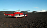
Where
no one has gone before, landing in the bowl of a volcanic
cone. Click to enlarge.
|

|
|
|
|

|
Peter
took the sledge hammer and obtained a sample of bedrock, later
the radioactive decay products contained in the feldspar crystals
would be measured to find the "age" of the rock,
the time since it solidified. (The dating technique starts
by placing the rock in a nuclear reactor to transmute potassium
into argon, alchemy in the service of geology.)
Jon carefully marked a rock, peter removed it with the sledge.
Later, in the lab, the magnetic field trapped by the cooling
lava would be measured. The magnetic field direction encodes
the latitude at which the rock cooled and also gives information
about the age of the rock.
|
|

|
|

|
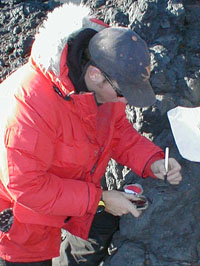
Jon
carefully marks the orientation of a rock, later its magnetic
field will be measured in the laboratory. Click to enlarge.
|

|
|
|
|

|
Peter
noticed that I was looking at the varied array of volcanic
rocks covering the ground. A few had fantastic shapes carved
by the wind. He mentioned that we were probably the first
people to ever walk on this ground. What an amazing experience,
to walk where no one had ever been before.
During
our 4 hour flight we photographed dozens of cones and landed
at seven of them. From the air I thought I could detect lines
of cones but since I work at the Exloratorium, "a museum
of science art and human perception," I know that the
human eye and brain can find lines where none exist. This
is why Terry and her team will mathematically analyze all
of their data to see if the alignments are real or not.
Once
their observations are published,then discussed and challenged
by other scientists, we may understand a bit more about the
stresses in the crust underlying McMurdo sound. For sure though,
I got a first hand view of modern geologists in action, using
helicopters and sledge hammers, air photos and notebooks,
alchemy and magnetism to explore the structure of the earth.
|

